Category:Burlescombe
Jump to navigation
Jump to search
English: Burlescombe is a village and civil parish in the Mid Devon district of Devon, England. According to the 2001 census it had a population of 911. The village is about 5 miles south-west of Wellington in Somerset.
village and civil parish in Devon, UK  | |||||
| Upload media | |||||
| Instance of | |||||
|---|---|---|---|---|---|
| Location | Mid Devon, Devon, South West England, England | ||||
 | |||||
Subcategories
This category has the following 6 subcategories, out of 6 total.
A
- Appledore, Mid Devon (2 F)
B
- Burlescombe railway station (5 F)
C
- Canonsleigh Abbey (7 F)
M
W
- Westleigh, Mid Devon (11 F)
Media in category "Burlescombe"
The following 200 files are in this category, out of 657 total.
(previous page) (next page)-
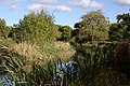 A Bend in the Canal - geograph.org.uk - 2228615.jpg 1,024 × 682; 271 KB
-
-
-
 A small covert near Oak Farm - geograph.org.uk - 3197772.jpg 1,024 × 768; 549 KB
-
 A small dock on the Grand Western Canal - geograph.org.uk - 3197845.jpg 1,024 × 768; 824 KB
-
 A38 at Southdown Cross - geograph.org.uk - 2131090.jpg 640 × 446; 70 KB
-
 A38 bridge over M5 on Maiden Down - geograph.org.uk - 2454643.jpg 800 × 600; 319 KB
-
 A38 bridge, M5 - geograph.org.uk - 5316296.jpg 640 × 426; 69 KB
-
 A38 Maiden Down junction - geograph.org.uk - 2791465.jpg 640 × 480; 61 KB
-
 A38 near Waterloo Cross - geograph.org.uk - 2130958.jpg 640 × 480; 109 KB
-
 Access bridge over the M5 - geograph.org.uk - 5536626.jpg 640 × 426; 49 KB
-
 Ancient mill at Fenacre - geograph.org.uk - 3421959.jpg 3,888 × 2,592; 3.29 MB
-
 Approaching a lay-by, A38 east - geograph.org.uk - 1626207.jpg 640 × 427; 344 KB
-
 Approaching Ebear Bridge from Westleigh - geograph.org.uk - 5090647.jpg 1,600 × 1,200; 803 KB
-
 Approaching Higher Houndaller Farm - geograph.org.uk - 2130970.jpg 640 × 480; 117 KB
-
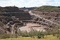
 At Westleigh Quarry - geograph.org.uk - 3199734.jpg 800 × 600; 95 KB
-
 Ayshford , The Grand Western Canal - geograph.org.uk - 2813280.jpg 4,288 × 2,848; 5.34 MB
-
 Ayshford Arms, Burlescombe - geograph.org.uk - 1779091.jpg 640 × 480; 53 KB
-
 Ayshford Arms, Burlescombe - geograph.org.uk - 3419573.jpg 3,888 × 2,592; 3.34 MB
-
 Ayshford Bridge - geograph.org.uk - 5490779.jpg 1,600 × 1,200; 850 KB
-
 Ayshford Court and chapel - geograph.org.uk - 5490780.jpg 1,600 × 1,200; 727 KB
-
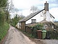
 Barn at Burlescombe - geograph.org.uk - 1779070.jpg 480 × 640; 99 KB
-
 Barn, Pugham Farm - geograph.org.uk - 5468128.jpg 640 × 426; 69 KB
-
 Beer Lane - geograph.org.uk - 4824051.jpg 1,024 × 768; 252 KB
-
 Black Bridge - geograph.org.uk - 5491537.jpg 1,600 × 1,200; 963 KB
-
 Black Bridge, Grand Western Canal - geograph.org.uk - 1246130.jpg 640 × 480; 74 KB
-

-
 Bridge for disused tramway - geograph.org.uk - 228331.jpg 640 × 480; 223 KB
-

-
 Bridge over the Fenacre Water - geograph.org.uk - 1779750.jpg 640 × 480; 107 KB
-

-
 Bridge over the M5 - geograph.org.uk - 5223538.jpg 640 × 426; 47 KB
-
 Bridge south of Burlescombe - geograph.org.uk - 2454654.jpg 800 × 600; 333 KB
-
 Bridge under former railway, Canonsleigh - geograph.org.uk - 5089501.jpg 1,600 × 1,200; 852 KB
-
 Broad Gauge Transfer Shed Didcot Railway Centre.jpg 2,048 × 1,362; 481 KB
-
 Bull at Pugham Farm - geograph.org.uk - 2520072.jpg 640 × 432; 177 KB
-
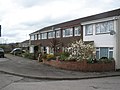
 Burlescombe , Burlescombe C Of E Primary School - geograph.org.uk - 5145062.jpg 5,141 × 3,427; 4.98 MB
-
 Burlescombe , Burlescome Church of England Primary School - geograph.org.uk - 4508963.jpg 3,801 × 2,525; 6.17 MB
-
 Burlescombe , Burlescome Church of England Primary School - geograph.org.uk - 4508969.jpg 4,288 × 2,848; 5.58 MB
-
 Burlescombe , Grand Western Canal - geograph.org.uk - 1331019.jpg 640 × 245; 42 KB
-

-

-

-
 Burlescombe , Grassy Field ^ Cattle - geograph.org.uk - 3029255.jpg 4,288 × 2,848; 4.72 MB
-
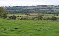
 Burlescombe , Mid Devon Scenery - geograph.org.uk - 3029256.jpg 4,288 × 2,848; 4.32 MB
-
 Burlescombe , Station Road - geograph.org.uk - 5145034.jpg 6,000 × 4,000; 5.7 MB
-

-
 Burlescombe , Village Road ^ Church - geograph.org.uk - 3029262.jpg 4,180 × 2,676; 4.09 MB
-

-
.jpg/120px-Burlescombe_-_Churchyard_%26_Village_Road_(geograph_1871403).jpg) Burlescombe - Churchyard & Village Road (geograph 1871403).jpg 3,264 × 2,448; 4.01 MB
Burlescombe - Churchyard & Village Road (geograph 1871403).jpg 3,264 × 2,448; 4.01 MB
-
.jpg/120px-Burlescombe_-_Churchyard_and_Countryside_(geograph_1871356).jpg) Burlescombe - Churchyard and Countryside (geograph 1871356).jpg 3,264 × 2,448; 3.74 MB
Burlescombe - Churchyard and Countryside (geograph 1871356).jpg 3,264 × 2,448; 3.74 MB
-
.jpg/120px-Burlescombe_-_Countryside_%26_Farm_Buildings_(geograph_1871434).jpg) Burlescombe - Countryside & Farm Buildings (geograph 1871434).jpg 3,264 × 2,448; 3.57 MB
Burlescombe - Countryside & Farm Buildings (geograph 1871434).jpg 3,264 × 2,448; 3.57 MB
-
.jpg/120px-Burlescombe_-_Countryside%2C_Railway_%26_M5_Motorway_(geograph_1871470).jpg) Burlescombe - Countryside, Railway & M5 Motorway (geograph 1871470).jpg 3,264 × 2,448; 3.17 MB
Burlescombe - Countryside, Railway & M5 Motorway (geograph 1871470).jpg 3,264 × 2,448; 3.17 MB
-
 Burlescombe - geograph.org.uk - 2311088.jpg 640 × 402; 70 KB
-

-
.jpg/120px-Burlescombe_-_Tree_%26_Countryside_(geograph_1871450).jpg) Burlescombe - Tree & Countryside (geograph 1871450).jpg 3,264 × 2,448; 3.49 MB
Burlescombe - Tree & Countryside (geograph 1871450).jpg 3,264 × 2,448; 3.49 MB
-
.jpg/120px-Burlescombe_-_Village_%26_Surroundings_(geograph_1871375).jpg) Burlescombe - Village & Surroundings (geograph 1871375).jpg 3,264 × 2,448; 3.73 MB
Burlescombe - Village & Surroundings (geograph 1871375).jpg 3,264 × 2,448; 3.73 MB
-
 Burlescombe Church - geograph.org.uk - 3419551.jpg 3,888 × 2,592; 3.09 MB
-
 Burlescombe from Fenacre Knap - geograph.org.uk - 3419527.jpg 3,888 × 2,592; 3.81 MB
-
 Burlescombe on the hill - geograph.org.uk - 5223552.jpg 640 × 426; 44 KB
-
 Burlescombe village hall - geograph.org.uk - 3197789.jpg 1,024 × 768; 633 KB
-
 Burlescombe warship geograph-2387917-by-Ben-Brooksbank.jpg 1,174 × 649; 369 KB
-
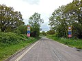
 Burlescombe, B3181 at Leonard Moor Cross - geograph.org.uk - 69232.jpg 640 × 415; 132 KB
-
 Burlescombe, by Westleigh Quarry - geograph.org.uk - 148465.jpg 640 × 427; 214 KB
-
 Burlescombe, Ebear Farm - geograph.org.uk - 68665.jpg 640 × 427; 94 KB
-
 Burlescombe, entrance to disused quarry - geograph.org.uk - 68679.jpg 640 × 427; 186 KB
-
 Burlescombe, Grand Western Canal - geograph.org.uk - 68669.jpg 640 × 415; 145 KB
-
-
 Burlescombe, Great Southdown Farm - geograph.org.uk - 98340.jpg 640 × 422; 112 KB
-
 Burlescombe, Houndaller Farm - geograph.org.uk - 69233.jpg 640 × 427; 118 KB
-
 Burlescombe, lane near Leonard Moor Cross - geograph.org.uk - 69228.jpg 640 × 427; 139 KB
-
 Burlescombe, Lower Ebear - geograph.org.uk - 68674.jpg 640 × 427; 157 KB
-
 Burlescombe, M5 Motorway - geograph.org.uk - 69236.jpg 640 × 418; 91 KB
-
 Burlescombe, muck spreading - geograph.org.uk - 49620.jpg 640 × 427; 141 KB
-
 Burlescombe, near Oak Farm - geograph.org.uk - 148462.jpg 640 × 427; 200 KB
-
 Burlescombe, near Penslade Farm - geograph.org.uk - 151348.jpg 640 × 427; 138 KB
-
 Burlescombe, old limekiln at Knowle Cross - geograph.org.uk - 68676.jpg 640 × 427; 202 KB
-
 Burlescombe, Pugham Farm - geograph.org.uk - 69240.jpg 640 × 427; 136 KB
-
 Burlescombe, railway at Eastbrook - geograph.org.uk - 57777.jpg 640 × 427; 160 KB
-
 Burlescombe, the A38 at Red Ball - geograph.org.uk - 146869.jpg 640 × 427; 108 KB
-
.jpg/120px-Burlescombe-_Railway_%26_Countryside_(geograph_1871380).jpg) Burlescombe- Railway & Countryside (geograph 1871380).jpg 3,264 × 2,448; 3.81 MB
Burlescombe- Railway & Countryside (geograph 1871380).jpg 3,264 × 2,448; 3.81 MB
-
 By the Exeter to Taunton line - geograph.org.uk - 5302925.jpg 640 × 426; 55 KB
-
 Byway by the railway - geograph.org.uk - 5223543.jpg 640 × 426; 66 KB
-

-
 Caged footpath over Grand Western Canal - geograph.org.uk - 3197827.jpg 1,024 × 768; 714 KB
-
 Canal at Ayshford - geograph.org.uk - 5490781.jpg 1,600 × 1,200; 788 KB
-
 Canal Boat and Houses - geograph.org.uk - 2228626.jpg 1,024 × 682; 215 KB
-
 Canal near Ebear - geograph.org.uk - 5490783.jpg 1,600 × 1,200; 788 KB
-
 Canal sluice gate near Ebear Bridge - geograph.org.uk - 227849.jpg 640 × 480; 212 KB
-
 Canal west of Ayshford - geograph.org.uk - 5490778.jpg 1,600 × 1,200; 820 KB
-

-
 Car Park, Tiverton Parkway Station - geograph.org.uk - 5159111.jpg 640 × 426; 56 KB
-
 Car park, Tiverton Parkway Station - geograph.org.uk - 5159112.jpg 640 × 426; 58 KB
-
 Chicken runs and an old stone wall, Canonsleigh - geograph.org.uk - 5089419.jpg 1,600 × 1,200; 780 KB
-
 Children's playground, Westleigh - geograph.org.uk - 5090577.jpg 1,600 × 1,200; 764 KB
-

-
 Cottage, Rocknell - geograph.org.uk - 3460795.jpg 640 × 480; 73 KB
-
 Cottages in Burlescombe - geograph.org.uk - 1779057.jpg 640 × 480; 84 KB
-
 Cottages, near Westleigh - geograph.org.uk - 1247408.jpg 640 × 480; 94 KB
-
 Crosse's Farm, Burlescombe - geograph.org.uk - 3419558.jpg 3,888 × 2,592; 3.01 MB
-
 Crossroads at Trumps - geograph.org.uk - 2428659.jpg 800 × 600; 418 KB
-
 Cutting on A38 bypassing Appledore - geograph.org.uk - 3197757.jpg 1,024 × 768; 685 KB
-
 Deer, Crossing Clay Lane - geograph.org.uk - 4822870.jpg 1,024 × 837; 257 KB
-
 Dismantled railway at Canonsleigh - geograph.org.uk - 5101775.jpg 1,600 × 1,200; 793 KB
-

-
 Ebear Bridge - geograph.org.uk - 227840.jpg 640 × 480; 209 KB
-
 Ebear bridge over canal and maintenance barge - geograph.org.uk - 5491526.jpg 1,600 × 1,200; 789 KB
-
 Ebear Bridge, Grand Western Canal - geograph.org.uk - 1246088.jpg 640 × 480; 82 KB
-
 Electricity pole and footpath - geograph.org.uk - 5089514.jpg 1,600 × 1,200; 745 KB
-
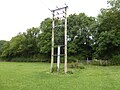
 Electricity sub-station, near Westleigh - geograph.org.uk - 1246447.jpg 640 × 480; 109 KB
-
 Electricity transformer station, Canonsleigh - geograph.org.uk - 5089463.jpg 1,200 × 1,600; 868 KB
-
 Entering Westleigh - geograph.org.uk - 3460806.jpg 640 × 480; 82 KB
-
 Entrance to rural units - geograph.org.uk - 3197730.jpg 1,024 × 765; 618 KB
-
 Entrance to Westleigh Quarry - geograph.org.uk - 3460812.jpg 640 × 480; 66 KB
-
 Entrance, Broadpath Landfill site - geograph.org.uk - 4822882.jpg 1,024 × 833; 240 KB
-
 Farm buildings at Rocknell Manor Farm - geograph.org.uk - 2428666.jpg 800 × 600; 459 KB
-
 Farm buildings near Fenacre Farm - geograph.org.uk - 3199664.jpg 800 × 600; 108 KB
-
 Farm buildings north-east of Appledore - geograph.org.uk - 1626208.jpg 640 × 427; 313 KB
-
 Farm buildings, Pugham Farm - geograph.org.uk - 4344701.jpg 640 × 430; 57 KB
-
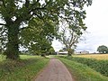
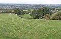
 Farmland near Trumps - geograph.org.uk - 3460789.jpg 640 × 480; 52 KB
-
 Farmland, Appledore - geograph.org.uk - 2131036.jpg 640 × 456; 64 KB
-
 Farmland, Rocknell - geograph.org.uk - 3460796.jpg 640 × 480; 56 KB
-
 Farmland, Spratford Stream Valley - geograph.org.uk - 4845745.jpg 640 × 426; 51 KB
-
 Fenacre Bridge - geograph.org.uk - 228337.jpg 640 × 480; 243 KB
-
 Fenacre Bridge on Grand Western Canal - geograph.org.uk - 3197847.jpg 1,024 × 768; 767 KB
-

-
 Fenacre Farm - geograph.org.uk - 1780005.jpg 640 × 480; 128 KB
-
 Fenacre Farm - geograph.org.uk - 3419503.jpg 3,888 × 2,592; 4.62 MB
-
 Fenacre farmhouse from cider barn - geograph.org.uk - 3421971.jpg 2,592 × 3,888; 4.97 MB
-
 Fenacre Quarry - geograph.org.uk - 3419499.jpg 3,888 × 2,592; 4.54 MB
-
 Fenacre Water - geograph.org.uk - 1779916.jpg 640 × 480; 107 KB
-
 Fences by the M5 - geograph.org.uk - 2131163.jpg 640 × 400; 67 KB
-
 Field at Little Southdown Farm - geograph.org.uk - 4824029.jpg 1,024 × 768; 199 KB
-
 Field at Red Ball - geograph.org.uk - 1778900.jpg 640 × 378; 78 KB
-
 Field boundary by the M5 - geograph.org.uk - 2131058.jpg 640 × 412; 80 KB
-
 Field by Great Covert - geograph.org.uk - 1778917.jpg 640 × 480; 85 KB
-
 Field east of Appledore - geograph.org.uk - 4717781.jpg 1,600 × 1,202; 1.13 MB
-
 Field near Tiverton Parkway Station - geograph.org.uk - 5302913.jpg 640 × 426; 35 KB
-
 Field near Whipcott Farm - geograph.org.uk - 1780034.jpg 640 × 443; 70 KB
-
 Field north-east of Appledore - geograph.org.uk - 1626201.jpg 640 × 427; 437 KB
-
 Field west of Grand Western Canal - geograph.org.uk - 3197824.jpg 1,024 × 768; 667 KB
-
 Field, Pound Farm - geograph.org.uk - 5102391.jpg 640 × 426; 46 KB
-
 Fields next to the Grand Western Canal - geograph.org.uk - 1304415.jpg 640 × 480; 157 KB
-
 Flat fields and pylon - geograph.org.uk - 5468129.jpg 640 × 426; 61 KB
-
_-_geograph.org.uk_-_5099111.jpg/120px-Footbridge_near_Fenacre_Farm_(2)_-_geograph.org.uk_-_5099111.jpg) Footbridge near Fenacre Farm (2) - geograph.org.uk - 5099111.jpg 1,600 × 1,200; 872 KB
Footbridge near Fenacre Farm (2) - geograph.org.uk - 5099111.jpg 1,600 × 1,200; 872 KB
-
 Footbridge near Fenacre Farm - geograph.org.uk - 3199645.jpg 768 × 1,024; 630 KB
-
 Footbridge near Fenacre Farm - geograph.org.uk - 5089406.jpg 1,200 × 1,600; 854 KB
-
 Footbridge near Fenacre Farm - geograph.org.uk - 5099110.jpg 1,600 × 1,200; 932 KB
-
-
 Footpath to kissing gate by Fenacre Farm - geograph.org.uk - 3199674.jpg 1,024 × 768; 655 KB
-
 Former petrol filling station, A38 west - geograph.org.uk - 1626192.jpg 640 × 427; 342 KB
-
 Former railway route to Burlescombe - geograph.org.uk - 5089508.jpg 1,600 × 1,200; 855 KB
-
 Former railway to Canonsleigh - geograph.org.uk - 5089505.jpg 1,600 × 1,200; 841 KB
-
 Former route of A38 in Appledore - geograph.org.uk - 3197763.jpg 1,024 × 768; 580 KB
-
 Fossend Bridge - geograph.org.uk - 1779164.jpg 640 × 480; 105 KB
-
 Fossend Bridge between Burlescombe and Westleigh - geograph.org.uk - 5491532.jpg 1,600 × 1,200; 777 KB
-
 Fossend Bridge over Grand Western Canal - geograph.org.uk - 3197804.jpg 1,024 × 768; 729 KB
-

-
 Fossend Bridge, near Westleigh - geograph.org.uk - 1246169.jpg 640 × 480; 86 KB
-
 Gate and footpath near Canonsleigh - geograph.org.uk - 5089468.jpg 1,200 × 1,600; 803 KB
-
 Goldsmoor - geograph.org.uk - 2506942.jpg 640 × 411; 67 KB
-
_-_geograph.org.uk_-_3365240.jpg/120px-Grand_Western_Canal_(4)_-_geograph.org.uk_-_3365240.jpg) Grand Western Canal (4) - geograph.org.uk - 3365240.jpg 3,072 × 2,048; 2.65 MB
Grand Western Canal (4) - geograph.org.uk - 3365240.jpg 3,072 × 2,048; 2.65 MB
-
_-_geograph.org.uk_-_3365256.jpg/120px-Grand_Western_Canal_(5)_-_geograph.org.uk_-_3365256.jpg) Grand Western Canal (5) - geograph.org.uk - 3365256.jpg 3,072 × 2,048; 2.99 MB
Grand Western Canal (5) - geograph.org.uk - 3365256.jpg 3,072 × 2,048; 2.99 MB
-
 Grand Western Canal - branching point - geograph.org.uk - 4412796.jpg 3,648 × 2,736; 2.82 MB
-
 Grand Western Canal - geograph.org.uk - 1767788.jpg 640 × 457; 75 KB
-
 Grand Western Canal - geograph.org.uk - 1767835.jpg 640 × 480; 95 KB
-
 Grand Western Canal - geograph.org.uk - 1767842.jpg 640 × 444; 93 KB
-
 Grand Western Canal - geograph.org.uk - 1779156.jpg 480 × 640; 85 KB
-
 Grand Western Canal - geograph.org.uk - 1969374.jpg 640 × 480; 86 KB
-
 Grand Western Canal - geograph.org.uk - 3460815.jpg 640 × 480; 92 KB
-
 Grand Western Canal - geograph.org.uk - 3460819.jpg 640 × 480; 106 KB
-
 Grand Western Canal - geograph.org.uk - 5189965.jpg 1,600 × 1,067; 832 KB
-
 Grand Western Canal - geograph.org.uk - 5189975.jpg 1,600 × 1,067; 578 KB
-
 Grand Western Canal - geograph.org.uk - 5189982.jpg 1,600 × 1,067; 917 KB
-
 Grand Western Canal - geograph.org.uk - 5190014.jpg 1,600 × 1,067; 488 KB
-
 Grand Western Canal - geograph.org.uk - 5190041.jpg 1,600 × 1,067; 574 KB
-
 Grand Western Canal - geograph.org.uk - 5191143.jpg 1,600 × 1,067; 576 KB
-
 Grand Western Canal at Ayshford - geograph.org.uk - 1767803.jpg 640 × 480; 88 KB
-
 Grand Western Canal at Ayshford - geograph.org.uk - 1767809.jpg 640 × 480; 71 KB
-

-

-
 Grand Western Canal from Ebear Bridge - geograph.org.uk - 5090651.jpg 1,600 × 1,200; 760 KB
-
 Grand Western Canal near Westleigh - geograph.org.uk - 4346077.jpg 640 × 397; 63 KB
-
 Grand Western Canal north of Fenacre Bridge - geograph.org.uk - 5089348.jpg 1,600 × 1,200; 782 KB
-
 Grand Western Canal north of Fossend - geograph.org.uk - 3197839.jpg 800 × 600; 120 KB
-
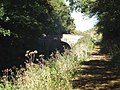
 Grand Western Canal Towpath - geograph.org.uk - 5190053.jpg 1,600 × 1,067; 912 KB
-
 Grand Western Canal towpath and phone mast - geograph.org.uk - 5090674.jpg 1,600 × 1,200; 786 KB
-

-
 Grazing land - geograph.org.uk - 4845770.jpg 640 × 426; 51 KB
-
 Grazing land - geograph.org.uk - 5102395.jpg 640 × 426; 39 KB
-
 Grazing land, Lyner Valley - geograph.org.uk - 4845767.jpg 640 × 426; 49 KB
-
 Grazing towards the River Lyner - geograph.org.uk - 4344697.jpg 640 × 506; 47 KB
-
 Grazing towards the River Lyner - geograph.org.uk - 4344704.jpg 640 × 408; 40 KB
-
 Great Southdown Farm - geograph.org.uk - 4717772.jpg 1,600 × 1,200; 1.33 MB
-
 Great Southdown Farm - geograph.org.uk - 4824642.jpg 1,024 × 816; 142 KB
-
 Great Western Canal - geograph.org.uk - 2311079.jpg 640 × 433; 81 KB
-

-

-
 Here the Grand Western Canal widens - geograph.org.uk - 5090671.jpg 1,600 × 1,200; 882 KB
-
 Higher Houndaller Farm - geograph.org.uk - 5362369.jpg 640 × 447; 35 KB


.jpg)
.jpg)
.jpg)
.jpg)

.jpg)
.jpg)


.jpg)


_-_geograph.org.uk_-_5099111.jpg)


_-_geograph.org.uk_-_3365240.jpg)
_-_geograph.org.uk_-_3365256.jpg)


