Category:United Kingdom photographs taken on 2010-03-03
Jump to navigation
Jump to search
Countries of Europe: Andorra · Austria · Belarus · Belgium · Czech Republic · Denmark · France‡ · Germany · Hungary · Italy · Malta · Netherlands‡ · Norway · Poland · Portugal‡ · Russia‡ · Slovakia · Spain‡ · Sweden · Switzerland · Turkey‡ · Ukraine · United Kingdom
‡: partly located in Europe
‡: partly located in Europe
| ← | 3 March 2010 | → | ||
| ← | March 2010 | → | ||

United Kingdom photographs taken on 3 March 2010.
Image files should be categorized here automatically using {{taken on}} template. Direct categorisation is also possible, if automatic is impossible.
Subcategories
This category has only the following subcategory.
Media in category "United Kingdom photographs taken on 2010-03-03"
The following 200 files are in this category, out of 730 total.
(previous page) (next page)-
 "Crow's foot", First Omagh Church - geograph.org.uk - 1733796.jpg 640 × 480; 83 KB
-
_-_geograph.org.uk_-_1735554.jpg/120px-%22Sea_mouse%22_(Aphrodita_aculeata)_-_geograph.org.uk_-_1735554.jpg) "Sea mouse" (Aphrodita aculeata) - geograph.org.uk - 1735554.jpg 640 × 482; 255 KB
"Sea mouse" (Aphrodita aculeata) - geograph.org.uk - 1735554.jpg 640 × 482; 255 KB
-
_-_geograph.org.uk_-_1736171.jpg/120px-%22Sea_mouse%22_(underside)_-_geograph.org.uk_-_1736171.jpg) "Sea mouse" (underside) - geograph.org.uk - 1736171.jpg 640 × 480; 255 KB
"Sea mouse" (underside) - geograph.org.uk - 1736171.jpg 640 × 480; 255 KB
-
.jpg/120px-43049_%2C_Ogston_(4403777901).jpg) 43049 , Ogston (4403777901).jpg 3,000 × 2,220; 3.86 MB
43049 , Ogston (4403777901).jpg 3,000 × 2,220; 3.86 MB
-
.jpg/120px-47739_and_421881_Ogston_(1).jpg) 47739 and 421881 Ogston (1).jpg 3,591 × 3,111; 8.39 MB
47739 and 421881 Ogston (1).jpg 3,591 × 3,111; 8.39 MB
-
 47739 and 421881 Ogston.jpg 2,500 × 1,971; 2.58 MB
-
.jpg/120px-66048_in_Inverness_(4404054407).jpg) 66048 in Inverness (4404054407).jpg 3,038 × 1,311; 513 KB
66048 in Inverness (4404054407).jpg 3,038 × 1,311; 513 KB
-
.jpg/120px-66048_in_Inverness_(4404818466).jpg) 66048 in Inverness (4404818466).jpg 3,264 × 2,448; 1.01 MB
66048 in Inverness (4404818466).jpg 3,264 × 2,448; 1.01 MB
-
 80-class railcars, Clipperstown - geograph.org.uk - 1735053.jpg 640 × 455; 97 KB
-

-

-
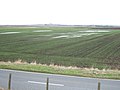 A paddy field ^ - geograph.org.uk - 1734760.jpg 2,848 × 2,136; 3.08 MB
-
 A pair of swans - geograph.org.uk - 1735049.jpg 2,848 × 2,136; 2.97 MB
-
 A passing pod of Dolphin - geograph.org.uk - 1734731.jpg 640 × 428; 66 KB
-
 A strip of land - The Ouse Washes near Earith - geograph.org.uk - 1734460.jpg 2,848 × 2,136; 2.91 MB
-
 A strong current - The Ouse Washes at Sutton Gault - geograph.org.uk - 1735007.jpg 2,848 × 2,136; 2.92 MB
-
 A38 at Red Ball - geograph.org.uk - 1778855.jpg 640 × 414; 57 KB
-
 Abandoned trailer in the woods - geograph.org.uk - 1734510.jpg 1,024 × 768; 174 KB
-

-
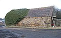 Agricultural building - geograph.org.uk - 1734646.jpg 3,984 × 2,517; 3.96 MB
-
 Alan Espey, Newtownards, March 2010.JPG 2,848 × 4,272; 3.73 MB
-
_(cropped).jpg/97px-Alexandra_Park_School_(4404603820)_(cropped).jpg) Alexandra Park School (4404603820) (cropped).jpg 572 × 707; 173 KB
Alexandra Park School (4404603820) (cropped).jpg 572 × 707; 173 KB
-
.jpg/120px-Alexandra_Park_School_(4404603820).jpg) Alexandra Park School (4404603820).jpg 1,232 × 816; 333 KB
Alexandra Park School (4404603820).jpg 1,232 × 816; 333 KB
-
 All Saints, Petham, Kent - Chancel - geograph.org.uk - 1736785.jpg 1,000 × 704; 211 KB
-
 All Saints, Petham, Kent - Chancel - geograph.org.uk - 1736786.jpg 1,000 × 661; 161 KB
-
 All Saints, Petham, Kent - Churchyard - geograph.org.uk - 1736807.jpg 1,000 × 667; 341 KB
-
 All Saints, Petham, Kent - East end - geograph.org.uk - 1736799.jpg 1,000 × 671; 224 KB
-
 All Saints, Petham, Kent - East end - geograph.org.uk - 1736803.jpg 1,000 × 765; 259 KB
-
 All Saints, Petham, Kent - Font - geograph.org.uk - 1736793.jpg 810 × 1,000; 188 KB
-
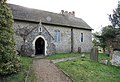 All Saints, Petham, Kent - geograph.org.uk - 1736783.jpg 1,000 × 684; 288 KB
-
 All Saints, Petham, Kent - geograph.org.uk - 1736805.jpg 1,000 × 662; 235 KB
-
 All Saints, Petham, Kent - geograph.org.uk - 1736812.jpg 1,000 × 698; 245 KB
-
 All Saints, Petham, Kent - Ledger slab - geograph.org.uk - 1736791.jpg 1,000 × 667; 224 KB
-
 All Saints, Petham, Kent - Painted beam - geograph.org.uk - 1736797.jpg 1,000 × 666; 201 KB
-
 All Saints, Petham, Kent - West door - geograph.org.uk - 1736809.jpg 630 × 1,000; 293 KB
-
 Alnwick branch of Sainsbury's - geograph.org.uk - 1734682.jpg 4,000 × 3,000; 4.1 MB
-
 Alnwick cemetery loopholed wall - geograph.org.uk - 1734741.jpg 4,000 × 3,000; 5.4 MB
-
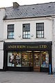 Anderson chemists, Newtownards, March 2010.JPG 2,848 × 4,272; 3.51 MB
-

-
 Approach to Colebrooke - geograph.org.uk - 1734888.jpg 640 × 480; 77 KB
-
 Approaching Howe's Brae - geograph.org.uk - 1741653.jpg 800 × 542; 140 KB
-
 April Cottage, Firgrove Road - geograph.org.uk - 1735486.jpg 640 × 480; 106 KB
-
 Ards Locksmiths, Newtownards, March 2010.JPG 2,848 × 4,272; 3.53 MB
-
 Ards Pet Supplies, Newtownards, March 2010.JPG 2,848 × 4,272; 3.77 MB
-
 Ards tourism information, Newtownards, March 2010.JPG 4,272 × 2,848; 4.18 MB
-
 Arnison Crag - geograph.org.uk - 1736002.jpg 640 × 480; 59 KB
-
 Artilleryman Public House Artillery Street, Colchester - geograph.org.uk - 1743354.jpg 3,264 × 2,448; 2.34 MB
-

-
 Ascending into Cold Cove - geograph.org.uk - 1736115.jpg 480 × 640; 82 KB
-
 ASDA store - Waterloo Road - geograph.org.uk - 1734026.jpg 922 × 691; 161 KB
-
 At a cross roads in Bangour - geograph.org.uk - 1735566.jpg 1,024 × 768; 137 KB
-
 Au Naturale, Newtownards, March 2010.JPG 4,272 × 2,848; 3.82 MB
-
 Awkward footpath to Lane End - geograph.org.uk - 1778539.jpg 480 × 640; 116 KB
-
 Ayshford Arms, Burlescombe - geograph.org.uk - 1779091.jpg 640 × 480; 53 KB
-
 B3391 near Woodlands - geograph.org.uk - 1778930.jpg 640 × 480; 92 KB
-

-
 Bangour Villa - geograph.org.uk - 1735304.jpg 1,024 × 768; 84 KB
-
 Bangour woods in the snow - geograph.org.uk - 1735559.jpg 1,024 × 768; 186 KB
-
 Bangour woods in winter - geograph.org.uk - 1735263.jpg 1,024 × 768; 148 KB
-
 Bank of Ireland, Newtownards, March 2010.JPG 2,848 × 4,272; 4.2 MB
-
 Barn at Burlescombe - geograph.org.uk - 1779070.jpg 480 × 640; 99 KB
-

-
 Beautilicious - Tong Street - geograph.org.uk - 1734483.jpg 640 × 492; 73 KB
-
 Beauty Clinic, Newtownards, March 2010.JPG 2,848 × 4,272; 3.6 MB
-
 Belly Busters - Tong Street - geograph.org.uk - 1734444.jpg 490 × 640; 73 KB
-
 Bench Mark, Bangor - geograph.org.uk - 1734512.jpg 640 × 459; 509 KB
-
 Bench Mark, Belfast - geograph.org.uk - 1734064.jpg 640 × 566; 524 KB
-
 Bench Mark, Helen's Bay - geograph.org.uk - 1734503.jpg 640 × 602; 767 KB
-
 Beside Busky Dike Lane - geograph.org.uk - 1737936.jpg 4,000 × 3,000; 4.65 MB
-
 BetFred - Tong Street - geograph.org.uk - 1734537.jpg 640 × 554; 74 KB
-
 Birchen Lee - geograph.org.uk - 1735769.jpg 640 × 480; 61 KB
-
 Blocked off road, Heartlands - geograph.org.uk - 1739006.jpg 640 × 480; 85 KB
-
 Bo Kong Takeaway - Tong Street - geograph.org.uk - 1734308.jpg 406 × 640; 58 KB
-
 Bog-field drain - geograph.org.uk - 1733941.jpg 3,072 × 2,304; 3.29 MB
-
 Bottomland trees - geograph.org.uk - 1738131.jpg 480 × 640; 119 KB
-
 Bowling News - Bowling Hall Road - geograph.org.uk - 1735213.jpg 480 × 640; 86 KB
-
 Bridge across the Ford Brook - geograph.org.uk - 1734059.jpg 640 × 480; 126 KB
-
_-_geograph.org.uk_-_1738484.jpg/90px-Bridge_on_the_move_(1-10)_-_geograph.org.uk_-_1738484.jpg) Bridge on the move (1-10) - geograph.org.uk - 1738484.jpg 415 × 553; 195 KB
Bridge on the move (1-10) - geograph.org.uk - 1738484.jpg 415 × 553; 195 KB
-
_-_geograph.org.uk_-_1738522.jpg/90px-Bridge_on_the_move_(10-10)_-_geograph.org.uk_-_1738522.jpg) Bridge on the move (10-10) - geograph.org.uk - 1738522.jpg 415 × 553; 178 KB
Bridge on the move (10-10) - geograph.org.uk - 1738522.jpg 415 × 553; 178 KB
-
_-_geograph.org.uk_-_1738488.jpg/90px-Bridge_on_the_move_(2-10)_-_geograph.org.uk_-_1738488.jpg) Bridge on the move (2-10) - geograph.org.uk - 1738488.jpg 415 × 553; 173 KB
Bridge on the move (2-10) - geograph.org.uk - 1738488.jpg 415 × 553; 173 KB
-
_-_geograph.org.uk_-_1738495.jpg/90px-Bridge_on_the_move_(3-10)_-_geograph.org.uk_-_1738495.jpg) Bridge on the move (3-10) - geograph.org.uk - 1738495.jpg 415 × 553; 168 KB
Bridge on the move (3-10) - geograph.org.uk - 1738495.jpg 415 × 553; 168 KB
-
_-_geograph.org.uk_-_1738500.jpg/90px-Bridge_on_the_move_(4-10)_-_geograph.org.uk_-_1738500.jpg) Bridge on the move (4-10) - geograph.org.uk - 1738500.jpg 415 × 553; 167 KB
Bridge on the move (4-10) - geograph.org.uk - 1738500.jpg 415 × 553; 167 KB
-
_-_geograph.org.uk_-_1738503.jpg/90px-Bridge_on_the_move_(5-10)_-_geograph.org.uk_-_1738503.jpg) Bridge on the move (5-10) - geograph.org.uk - 1738503.jpg 415 × 553; 173 KB
Bridge on the move (5-10) - geograph.org.uk - 1738503.jpg 415 × 553; 173 KB
-
_-_geograph.org.uk_-_1738507.jpg/90px-Bridge_on_the_move_(6-10)_-_geograph.org.uk_-_1738507.jpg) Bridge on the move (6-10) - geograph.org.uk - 1738507.jpg 415 × 553; 178 KB
Bridge on the move (6-10) - geograph.org.uk - 1738507.jpg 415 × 553; 178 KB
-
_-_geograph.org.uk_-_1738511.jpg/90px-Bridge_on_the_move_(7-10)_-_geograph.org.uk_-_1738511.jpg) Bridge on the move (7-10) - geograph.org.uk - 1738511.jpg 415 × 553; 177 KB
Bridge on the move (7-10) - geograph.org.uk - 1738511.jpg 415 × 553; 177 KB
-
_-_geograph.org.uk_-_1738514.jpg/90px-Bridge_on_the_move_(8-10)_-_geograph.org.uk_-_1738514.jpg) Bridge on the move (8-10) - geograph.org.uk - 1738514.jpg 415 × 553; 178 KB
Bridge on the move (8-10) - geograph.org.uk - 1738514.jpg 415 × 553; 178 KB
-
_-_geograph.org.uk_-_1738519.jpg/90px-Bridge_on_the_move_(9-10)_-_geograph.org.uk_-_1738519.jpg) Bridge on the move (9-10) - geograph.org.uk - 1738519.jpg 415 × 553; 176 KB
Bridge on the move (9-10) - geograph.org.uk - 1738519.jpg 415 × 553; 176 KB
-
 Bridge over the Fenacre Water - geograph.org.uk - 1779750.jpg 640 × 480; 107 KB
-
 Bridleway, to Wears Hill, Dorset - geograph.org.uk - 1735854.jpg 1,024 × 768; 169 KB
-
 Broadway Cafe, Newtownards, March 2010.JPG 2,848 × 4,272; 3.22 MB
-
 Brockenhurst , New Forest Cycle Hire - geograph.org.uk - 1737862.jpg 3,200 × 2,362; 1.09 MB
-
 Brocks Cross, the turning for Bow - geograph.org.uk - 1734896.jpg 640 × 480; 47 KB
-
 Broomhill Cross - geograph.org.uk - 1734958.jpg 640 × 480; 117 KB
-
 Brown Hill Farm - geograph.org.uk - 1734413.jpg 2,816 × 2,112; 1.08 MB
-
 Brox Burn at Dechmont - geograph.org.uk - 1735266.jpg 1,024 × 768; 124 KB
-
%2C_Belfast_-_geograph.org.uk_-_1736277.jpg/120px-Bruce_Street_(western_end)%2C_Belfast_-_geograph.org.uk_-_1736277.jpg) Bruce Street (western end), Belfast - geograph.org.uk - 1736277.jpg 3,648 × 2,736; 2.21 MB
Bruce Street (western end), Belfast - geograph.org.uk - 1736277.jpg 3,648 × 2,736; 2.21 MB
-
 Burn, Heartlands - geograph.org.uk - 1738998.jpg 640 × 359; 88 KB
-
 Butsford Bridge Cross - geograph.org.uk - 1734928.jpg 640 × 480; 91 KB
-
 Byway leading from Dotland - geograph.org.uk - 1737559.jpg 600 × 450; 409 KB
-
 Cafe Mocha, Newtownards, March 2010.JPG 2,848 × 4,272; 2.53 MB
-
 Cafollas cafe, Newtownards, March 2010.JPG 2,848 × 4,272; 4.11 MB
-
 Cairn, Aiken Crag - geograph.org.uk - 1736650.jpg 640 × 480; 68 KB
-
 Cairn, Aiken Crag - geograph.org.uk - 1736652.jpg 480 × 640; 87 KB
-
 Caldwell's Luxury Ice Cream - geograph.org.uk - 1741670.jpg 800 × 604; 148 KB
-
 Captain Cartridge - Tong Street - geograph.org.uk - 1734451.jpg 480 × 640; 82 KB
-
 Caravan Site - geograph.org.uk - 1735055.jpg 3,648 × 2,736; 4.25 MB
-
 Card Land, Newtownards, March 2010.JPG 2,848 × 4,272; 4.27 MB
-
 Carn Thòmais from Suidhe - geograph.org.uk - 1734035.jpg 3,264 × 2,448; 1.63 MB
-
 Carnduff butchers, Newtownards, March 2010.JPG 4,272 × 2,848; 3.94 MB
-
 Carrickfergus Gospel Hall - geograph.org.uk - 1734039.jpg 640 × 377; 73 KB
-
 Castle Boulevard - geograph.org.uk - 1733905.jpg 1,600 × 1,066; 471 KB
-
 Castle Boulevard - geograph.org.uk - 1736455.jpg 1,024 × 683; 352 KB
-
 Castle Court - geograph.org.uk - 1734201.jpg 1,600 × 891; 360 KB
-
 Castle Court - geograph.org.uk - 1736444.jpg 683 × 1,024; 341 KB
-
 Catley Lane Head - geograph.org.uk - 1734421.jpg 2,816 × 2,112; 2.12 MB
-
.jpg/120px-Ceremonial_Welcome_(4403964442).jpg) Ceremonial Welcome (4403964442).jpg 1,232 × 816; 431 KB
Ceremonial Welcome (4403964442).jpg 1,232 × 816; 431 KB
-
 Chans Cuisine, Newtownards, March 2010.JPG 2,848 × 4,272; 3.68 MB
-
 Chelwood Butchers - Tong Street - geograph.org.uk - 1735196.jpg 640 × 504; 81 KB
-

-
 Christchurch Gardens - geograph.org.uk - 1735470.jpg 640 × 480; 114 KB
-

-
 Cineworld cinemas in Middlesbrough - geograph.org.uk - 1734529.jpg 3,088 × 2,056; 1.92 MB
-
_-_geograph.org.uk_-_1734994.jpg/120px-Clipperstown_station%2C_Carrickfergus_(2)_-_geograph.org.uk_-_1734994.jpg) Clipperstown station, Carrickfergus (2) - geograph.org.uk - 1734994.jpg 640 × 398; 101 KB
Clipperstown station, Carrickfergus (2) - geograph.org.uk - 1734994.jpg 640 × 398; 101 KB
-
 Clives Country Corner, Newtownards, March 2010.JPG 2,848 × 4,272; 3.54 MB
-
 Coastguard Building, Lerwick - geograph.org.uk - 1734978.jpg 800 × 534; 149 KB
-
 Cockshotts Place - geograph.org.uk - 1736532.jpg 1,080 × 984; 939 KB
-
 Cockshutt Road, Beauchief, Sheffield - geograph.org.uk - 1735958.jpg 640 × 480; 85 KB
-
 Cold and grey - The Ouse Washes near Earith - geograph.org.uk - 1734445.jpg 2,848 × 2,136; 2.89 MB
-
 Cold Cove - geograph.org.uk - 1736139.jpg 480 × 640; 98 KB
-
 Coldcove Gill - geograph.org.uk - 1736154.jpg 640 × 480; 83 KB
-
 Coldcove Gill - geograph.org.uk - 1736174.jpg 480 × 640; 87 KB
-
 Coldcove Gill - geograph.org.uk - 1736186.jpg 640 × 480; 84 KB
-
 Coldcove Gill - geograph.org.uk - 1736197.jpg 480 × 640; 95 KB
-
 Coldcove Gill - geograph.org.uk - 1736580.jpg 640 × 480; 81 KB
-
 Communications mast above Trythogga - geograph.org.uk - 1745123.jpg 427 × 640; 74 KB
-
 Control Tower Erroll Airfield - geograph.org.uk - 1743006.jpg 3,072 × 2,304; 1.06 MB
-
 Copthall Green, Good Intent - geograph.org.uk - 1750533.jpg 640 × 480; 68 KB
-
 Cordners Kids, Newtownards, March 2010.JPG 4,272 × 2,848; 4.07 MB
-
 Cordners shoe shop, Newtownards, March 2010.JPG 2,848 × 4,272; 3.54 MB
-
 Cosy Corner Sandwich Bar - Rook Lane - geograph.org.uk - 1735206.jpg 640 × 585; 84 KB
-
 Cotswold barns for sale Cockadilly - geograph.org.uk - 1734779.jpg 640 × 480; 56 KB
-
 Cottage near Newbiggin Hill - geograph.org.uk - 1737511.jpg 600 × 450; 246 KB
-
 Cottage, Lane End - geograph.org.uk - 1778711.jpg 640 × 480; 118 KB
-
 Cottages in Burlescombe - geograph.org.uk - 1779057.jpg 640 × 480; 84 KB
-
 Crannogs on frozen Loch Tarff - geograph.org.uk - 1734032.jpg 3,264 × 2,448; 1.73 MB
-
 Crawford School Wear, Newtownards, March 2010.JPG 4,272 × 2,848; 4.69 MB
-
 Croydon, Lebanon Road - geograph.org.uk - 1734447.jpg 3,456 × 2,304; 4.78 MB
-
 Croydon, Lebanon Road tram stop - geograph.org.uk - 1734341.jpg 2,526 × 1,764; 3.25 MB
-
 Croydon, St. Mary Magdalene vicarage, Canning Road - geograph.org.uk - 1734266.jpg 3,456 × 2,304; 5.63 MB
-
 Croydon, The 'Cricketers', Addiscombe Road - geograph.org.uk - 1734310.jpg 3,456 × 2,304; 4.65 MB
-
 Croydon, The 'Cricketers', Addiscombe Road - geograph.org.uk - 1734320.jpg 3,456 × 2,304; 4.76 MB
-
 Dairy House, Steel - geograph.org.uk - 1738825.jpg 600 × 450; 253 KB
-
 Dalswinton Loch - geograph.org.uk - 1735305.jpg 3,888 × 1,950; 566 KB
-
 Debdale Lane - geograph.org.uk - 1735219.jpg 533 × 640; 83 KB
-
 Deep water on the road - The Ouse washes at Sutton Gault - geograph.org.uk - 1735017.jpg 2,848 × 2,136; 2.98 MB
-
 Deepdale Beck - geograph.org.uk - 1738077.jpg 640 × 480; 91 KB
-
 Deepdale Park - geograph.org.uk - 1736080.jpg 640 × 480; 74 KB
-
 Deer grazing in Gleann nan Eun - geograph.org.uk - 1734043.jpg 3,264 × 2,448; 1.59 MB
-
 Deli Cuisine - Tong Street - geograph.org.uk - 1735182.jpg 640 × 536; 68 KB
-
 Departing Clipperstown station - geograph.org.uk - 1735028.jpg 640 × 442; 94 KB
-
 Descending Birks - geograph.org.uk - 1736606.jpg 640 × 480; 82 KB
-
 Descending Frocester Hill - geograph.org.uk - 1734790.jpg 640 × 462; 62 KB
-
 Dinkling Green - geograph.org.uk - 1735789.jpg 640 × 480; 82 KB
-
 Distinctive Kitchens - Tong Street - geograph.org.uk - 1734542.jpg 640 × 480; 90 KB
-
 Disused building at Bangour - geograph.org.uk - 1735283.jpg 1,024 × 768; 133 KB
-
 Disused nurses' home at Bangour - geograph.org.uk - 1735312.jpg 1,024 × 768; 127 KB
-
 Disused villa at Bangour - geograph.org.uk - 1735307.jpg 1,024 × 768; 137 KB
-
 Diva Bridal Wear - Tong Street - geograph.org.uk - 1734501.jpg 480 × 640; 67 KB
-
 Dotland Farmhouse - geograph.org.uk - 1737886.jpg 600 × 450; 274 KB
-
 Dotland Farmhouse - geograph.org.uk - 1737887.jpg 600 × 450; 295 KB
-
 Dotland Park Farmhouse - geograph.org.uk - 1737550.jpg 600 × 450; 219 KB
-
 Dotland Shrunken Medieval Village - geograph.org.uk - 1737588.jpg 600 × 450; 286 KB
-
 Doubler Stone - geograph.org.uk - 1736976.jpg 1,368 × 857; 206 KB
-
 Dragon King Takeaway - Tong Street - geograph.org.uk - 1734507.jpg 640 × 637; 99 KB
-
 Drainage Sike near Whitley Mill - geograph.org.uk - 1737890.jpg 600 × 450; 376 KB
-
 East Ford below Froggy Mill Cross - geograph.org.uk - 1734040.jpg 640 × 480; 122 KB
-
 East Studham Cross - geograph.org.uk - 1734848.jpg 640 × 480; 108 KB
-
 Edinburgh Woollen Mill, Newtownards, March 2010.JPG 4,272 × 2,848; 4.51 MB
-
 Epping Forest, Claypit Hill - geograph.org.uk - 1743102.jpg 640 × 480; 91 KB
-
 Epping Forest, Honey Lane shelter - geograph.org.uk - 1750327.jpg 640 × 480; 86 KB
-

-
 Ethel Austin, Newtownards, March 2010.JPG 4,272 × 2,848; 3.84 MB
-
 Excel, Newtownards, March 2010.JPG 4,272 × 2,848; 3.43 MB
-
 Exchange Court sign, Newtownards, March 2010.JPG 4,272 × 2,848; 4.95 MB
-
 Exchange Court waste bin, Newtownards, March 2010.JPG 4,272 × 2,848; 3.53 MB
-
 Exchange Court, Newtownards, March 2010.JPG 4,272 × 2,848; 3.49 MB
-

-
 Falinge Fold - geograph.org.uk - 1734859.jpg 1,632 × 1,224; 412 KB
-
 Falinge Park - geograph.org.uk - 1734852.jpg 1,600 × 1,200; 568 KB
-
 Farm at Red Ball - geograph.org.uk - 1778873.jpg 640 × 452; 87 KB
-
 Farm gate near Dinkling Green - geograph.org.uk - 1735796.jpg 2,592 × 1,944; 1.58 MB
-
 Farmhouse, Steel - geograph.org.uk - 1738812.jpg 600 × 450; 271 KB
-
 Favourite Walk - geograph.org.uk - 1735212.jpg 607 × 640; 195 KB
-
 Feminine Touch mural, Newtownards, March 2010.JPG 2,848 × 4,272; 4.48 MB
-
 Feminine Touch, Newtownards, March 2010.JPG 2,848 × 4,272; 3.74 MB
-
 Fenacre Farm - geograph.org.uk - 1780005.jpg 640 × 480; 128 KB
-
 Fenacre Water - geograph.org.uk - 1779916.jpg 640 × 480; 107 KB
-

-
 Fenland track south of Sutton In The Isle - geograph.org.uk - 1734876.jpg 2,848 × 2,136; 3.17 MB
-


_-_geograph.org.uk_-_1735554.jpg)
_-_geograph.org.uk_-_1736171.jpg)
.jpg)
.jpg)

.jpg)
.jpg)


_(cropped).jpg)
.jpg)


_-_geograph.org.uk_-_1738484.jpg)
_-_geograph.org.uk_-_1738522.jpg)
_-_geograph.org.uk_-_1738488.jpg)
_-_geograph.org.uk_-_1738495.jpg)
_-_geograph.org.uk_-_1738500.jpg)
_-_geograph.org.uk_-_1738503.jpg)
_-_geograph.org.uk_-_1738507.jpg)
_-_geograph.org.uk_-_1738511.jpg)
_-_geograph.org.uk_-_1738514.jpg)
_-_geograph.org.uk_-_1738519.jpg)


,_Belfast_-_geograph.org.uk_-_1736277.jpg)


.jpg)


_-_geograph.org.uk_-_1734994.jpg)


